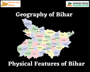
Physical Features of Bihar
The natural features of Bihar can be divided into three parts on the basis of drainage system, rainfall, nature of soil, etc.
- Himalayan Mountainous Region
- Bihar (Indo-Gangetic) Plain
- Narrow Plateau of South
1. Himalayan Mountainous Region
The mountain belt in the north-west of Ganga in Bihar is known as Shiwalik range. The area of this small region is located in the north-east of Bihar is 932 sq. km.
It has three sub-divisions
- Ramnagar Dun: The maximum height of these small hills spreading over an area of 214 sq km is 240 m (near Santpur). This is also known as south range.
- Someshwar Range: The upper part of this range, spreading over an area of approximately 75 sq km. from Triveni Nagar in the west to Bhikhnathori acts as boundary between Bihar and Nepal.
-
- The highest peak of this range is The Someshwar, Bhikhnathori (Kudi River), and Marvat (Harha River) are important passes located here, which are formed as a result of the river erosion.
- Dun Valley: This valley lies in between Ramnagar Dun and Someshwar range. This valley, about 24 km long and higher than the alluvial plain of Ganga, is also known as the Harha river valley.
-
- Ramnagar Dun and Someshwar are the important ranges in this mountain chain.
- Its total area is 586 sq km.
- The range of Someshwer draws a 60 km long boundary line from northern boundary of Bihar.
- The rivers in this range form passes like Bhikhna, Someshwar, and Makhat.
2. Indo-Gangetic plain of Bihar
- Area-90,650 sq km (approximately 95% of the total area of Bihar)
- Bihar or Indo-Gangetic plain can be divided into two parts-
- Plain of Northern Bihar
- Plain of Southern Bihar
Plain of Northern Bihar
The North Bihar plain can be divided into following parts:
- Mahananda Plain: It is the easternmost part of the North Bihar plain. Its boundary is demarcated by Indo-Nepal border in the north, river Ganga in the south, West Bengal in the east and river Kosi in the west.
- Kosi Plain: It is surrounded by Mahananda plain in the east, river Kamala in the west, Nepal border in the north and river Ganga in the south. It extends in the districts of Supaul, Saharsa, Madhepura, Madhubani, Darbhanga. The river Kosi is known to change its course and hence, it is the most flood affected area of Bihar.
-
- Kamala Plain: It is located in the central part of the North Bihar plain. It is surrounded by Kosi plain in the east, Bagmati plain in the west, Indo-Nepal border in the north and river Ganga in the south. The river Kamala also changes its course, due to which a large number of chaurs are formed in the regions.
- Bagmati Plain: It is situated between Kamala plain in the east and Gandak plain in the west. It includes the districts of Sitamarhi, Muzaffarpur, Samastipur, East Champaran and Sheohar. A number of chaurs are formed in the region.
- Gandak Plain: It extends between Bagmati and Ghaghra plains.
- Ghaghra Plain: It is the westernmost part of the North Bihar plain. It includes the districts of Siwan, Gopalganj and Saran.
Plain of Southern Bihar
- The South Ganga Plain extends from the south of Ganga upto the north of Chhota Nagpur plateau. It has an area of 33,670 sq. km. It is smaller than the North Bihar plain, is triangular in shape with wider west and narrower east part.
- A number of hills are located in this plain, such as Barabar hills, Rajgir- Jethian hills, Giriak hills and Kharagpur hills which lie in the districts of Jehanabad, Nalanda and Munger.
- These hills are the outlier of Chhota Nagpur plateau and are termed a residual hills. The Rajmahal hills form the north-east angle of the Chhota Nagpur plateau and approach the Ganga in its course in that region.
- The South Gangetic plain differs in many respect from the North Gangetic Plain. It is higher in the south and slopes towards the Ganga, but the slope is not so gradual as in North Gangetic plain. While the north is liable to flood and change, the south Gangetic plain is stable and not subject to flood except in limited areas.
The south Bihar plain can be divided into following parts:
- Chandan Plain: It is the easternmost part of south Ganga plain and includes Banka and Bhagalpur districts. The Chandan river originates from the Digharia Hills which is a part of Rajmahal Hills.
- Kiul Plain: It is located to the western side of Chandan plain and east of Tal region. The Kharagpur hills form a watershed region between Kiul and Maan rivers.
- Tal Region: it is a low lying region which is filled with water during rainy season. Tal region is surrounded by Kuil plain in the east and Magadha plain in the west. The alluvium deposit is important for rabi crops.
- Central South Bihar Plain: It is triangular in shape, and is surrounded by river Ganga in the north, some in the west and Tal region in the east. It extends to an area of 17 thousand square kilometre and includes the district of Gaya, Aurangabad, Jehanabad, Patna, Nalanda and Nawada.
- Shahabad Plain: It is the westernmost part of south Bihar plain. Its boundaries are demarcated by river Ganga on the north, Kaimur plateau in the south, river Son in the east and river Karmanasha in the west. It includes Bhojpur, Buxar and some parts of Kaimur district. This plain is suitable for the cultivation of rice.
3. Narrow Plateau of South
- This plateau spreads from Kaimur to Munger and Banka districts in the east. In reality, it is the outer part of Peninsular plateau.
- Its area is around 2,581 sq km.
- It has two parts- (a) Plateau of Kaimur and (b) Hills of Kharagpur
- Plateau of Kaimur
- Area-1,280 sq km.
- This is also known as Plateau of Rohtas. Rohtasgarh is situated at the height of 454 m at this plateau.
- Primarily limestone, pyrite, sand for glass making and sandstone are found.
- Hills of Kharagpur
- Area 1,300 sq. km. It is situated in Munger, mainly, but its spread is upto Banka in the east and Jamui in the south.
- Its height is 450 m.
- Granite, shell, slate, and quartzite rocks are found in the hills of Kharagpus A A Granite, shell, slate, and quartzite rocks are found in the hills.
|